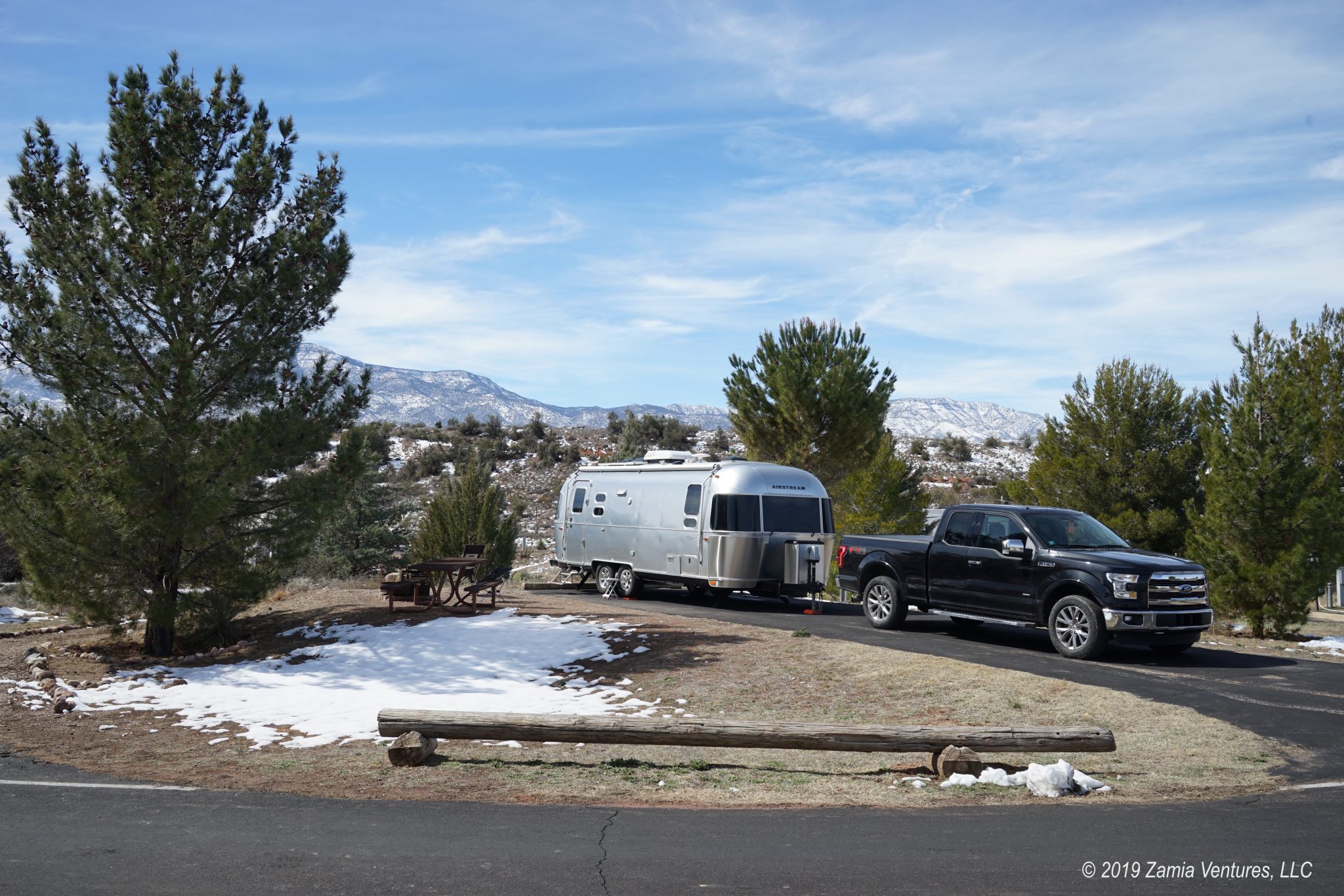
To support Ken’s medical treatments, we spent 10 days ensconced in a private RV park in the tiny town of Monticello, Utah, 50 miles south of Moab. While daily drives up to Moab for Ken’s IV antibiotic treatments absorbed a lot of our time, I also had the opportunity to take a few trips to some of the natural features in the area. The sicky stayed home to recuperate. It turns out that Monticello is a fairly good base of operations to visit some additional geological wonders of southeast Utah, though everything is so spread out that quite a bit of driving is required to access these locations. This week we racked up one of our largest weekly mileage totals since we’ve been on the road, but at least we were spending hours on roads that are not particularly busy and are incredibly scenic.
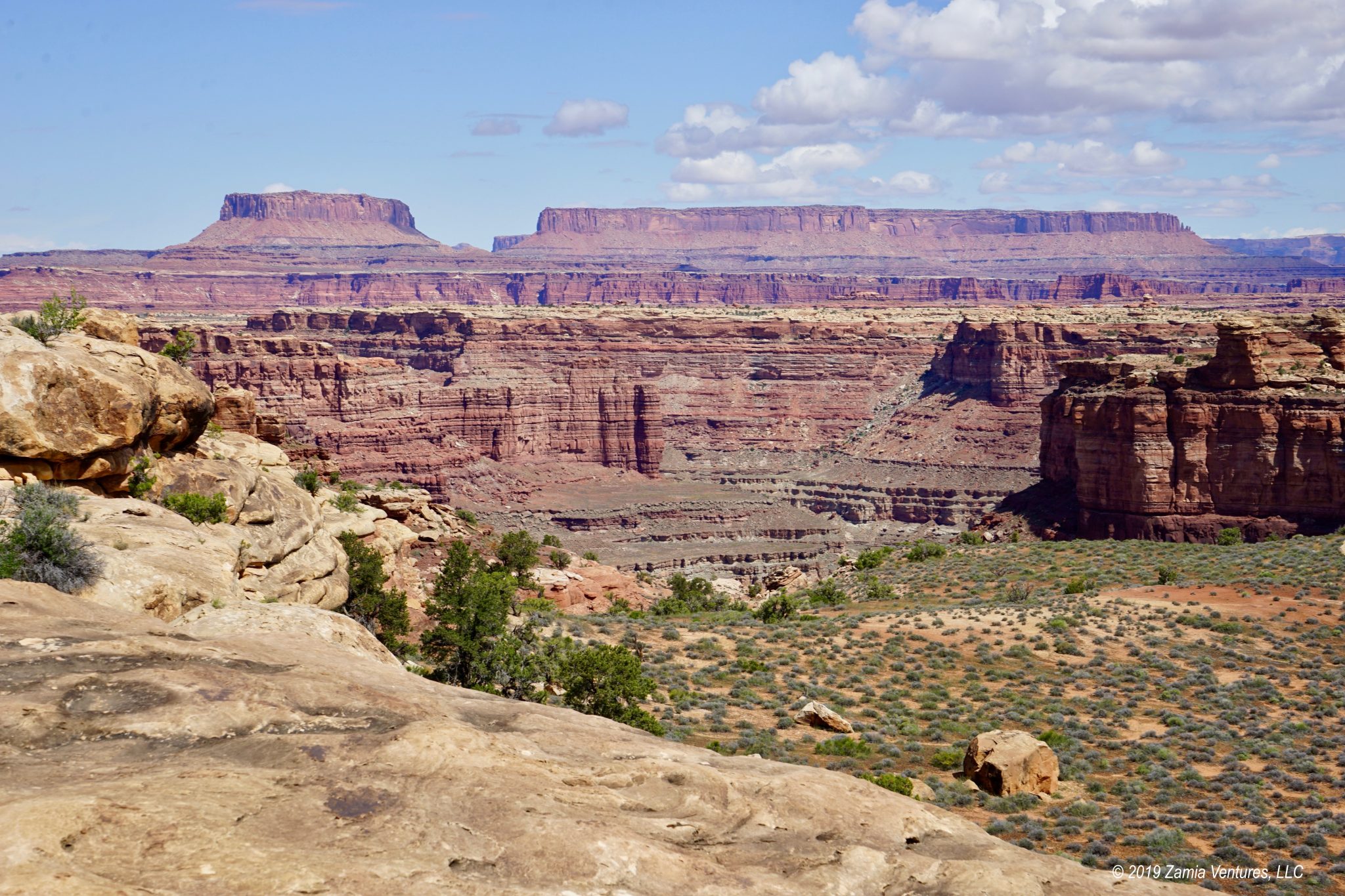
Canyonlands NP Needles District
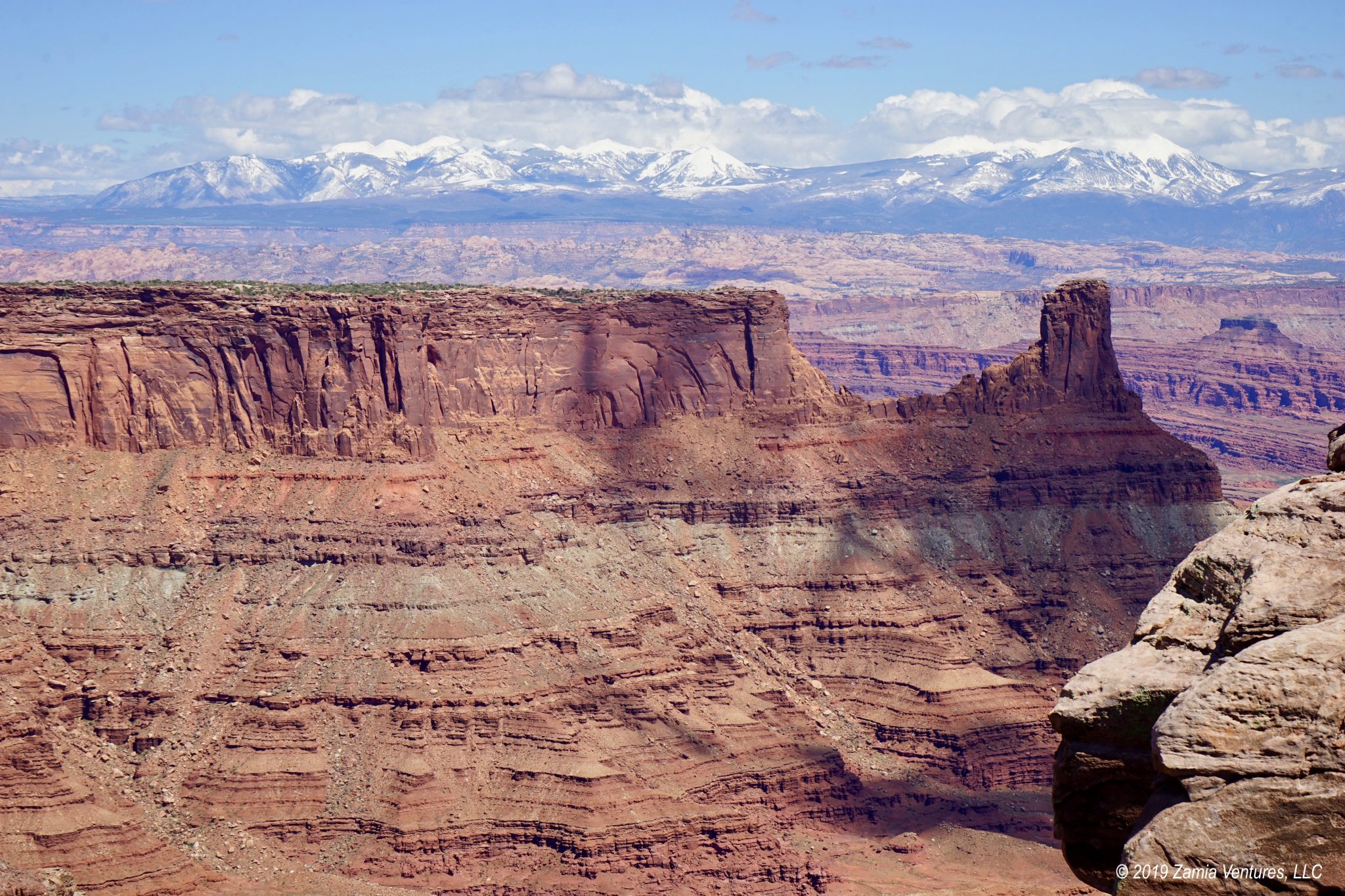
Monticello is the closest town to the Needles District of Canyonlands National Park, and this section of the park feels quite remote and lightly visited. I thought it absolutely rivaled the Islands in the Sky District in terms of interesting geological features. The most notable are the thin eroded needles of sandstone that give the district its name, but there is much more to see here. There are also toadstool formations, created when soft sandstone lies beneath a layer of harder rock and the sandstone is eroded into a thin stem with a bulbous top resembling a mushroom. The Needles District also has plenty of mesas, buttes, arches, and canyons giving texture to the landscape. I particularly liked the views looking north, which gave an entirely new perspective on the deep canyons and high mesa of the Islands in the Sky District. The Junction Butte at the junction of the Colorado and Green Rivers was almost unrecognizable from this different perspective.


The story of the formation of the needles is similar to the story at nearby Arches National Park: an uplift created a checkerboard pattern of cracks in the earth, which were weathered over time into thin spindles. The most interesting experience of the needles is undoubtedly from the trails located in the Elephant Hill area, where hikers wander through the deep canyons between these vertical formations. But for an introduction to the variety of different park features, including stunning views looking north toward the Islands in the Sky section of the park, the relatively short Slickrock Foot Trail was a winner in my book.


Natural Bridges National Monument
The other major destination I explored from Monticello is Natural Bridges National Monument. This small park can be explored pretty fully in just one day, which is nice because it’s a long drive out toward the middle of nowhere to access the park. The main features are, as one might guess, three natural bridges — not to be confused with arches. Unlike arches, natural bridges are carved by water flowing underneath to create the aperture. A natural bridge starts off with a meandering river that carves an S-shaped course with plenty of points jutting out. Eventually, the water breaks through the point, avoiding the long way around, and carves an opening through the point to create a natural bridge. Flowing water will continue to eat away at the base of the bridge until it eventually collapses.


The flowing water at Natural Bridges is charitably described as “creeks” — it’s hard to believe that those tiny trickles carved out these huge bridges! There are occasional flash floods that must be doing most of the work, because the tiny rivulets I saw were just too small and tame to perform much erosion. And I can confirm the volume of the creeks from first-hand observation, since each of the bridges offers a hike from the canyon rim down to the base of the bridge, and only filament-thin Owachomo Bridge no longer has water flowing underneath it. The hikes down into the canyons were relatively short and fun, with changing views of the bridges and interesting plant communities to be found at different levels of the canyon. Unfortunately the only way to get back to the truck was to hike back up, which was considerably less fun and seemed at least three times as long, especially considering the rickety ladders that were involved in the climb on one of the trails.


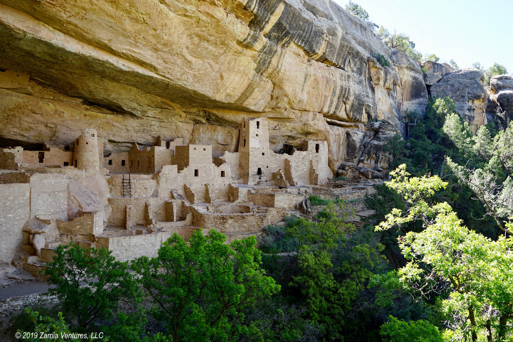
The park also has an area with ruins of cliff dwellings, which can be seen across the canyon. The short hike to the Horsecollar Ruins overlook was fairly level, and my biggest challenge was actually spotting the ruins on the opposite cliff wall. The bricks were obviously made from local materials and blended perfectly into the natural stone, but eventually I located the remains of a small ancient community tucked into an alcove in the cliff wall.
Monticello
Since we usually camp inside national and state parks, we often don’t spend much time in towns. During our month-long sojourn in southern Utah our main reasons for visiting towns have been to get gas, stock up on groceries, and do laundry. In contrast, our medically-induced stay in the town of Monticello gave us a chance to get to know this small community a little better. Spending 10 days in a tiny town (population under 2,000) with exactly one traffic light gave us an appreciation for life in rural Utah.
As I learned from my visit to the small (but free!) Frontier Museum on Main Street, Monticello, the community was founded in 1888 by a group of Mormon pioneers who were sent to the area from an existing community in Bluff, located 45 miles to the south. Some of the founders had come west in handcart companies before 1860. I suppose that in comparison to that treacherous journey the founding of a brand new town in a remote area was a snap. The Frontier Museum was compiled from materials donated by residents and that origin story is definitely reflected in the total randomness of the collection. In some cases this can work out well — I loved the similarly-constituted Wellfleet Historical Museum on Cape Cod. Here, not so much. But it was still a source of interesting trivia about the town.
My favorite factoids related to Marie Ogden, a “spiritualist” and founder of the Home of Truth religious community located just outside Monticello in the 1930s. Ms. Ogden and her followers believed that she was the reincarnation of the Virgin Mary, and that their commune would be the location of the Second Coming of Christ. In addition to running a religious community, Ogden purchased the local paper (the San Juan Record) and installed herself as editor. It was handy that she claimed to receive divine revelations via her typewriter, and the newspaper provided an outlet for her to share her spiritual views with the entire county. I can’t even imagine what the local Mormon community must have thought of this group.


The LDS church is obviously dominant in town. The main public building in the community — the office building that houses operations for San Juan County — is flanked by one Mormon church, while there is a second LDS church just four blocks away next to the Monticello Temple. Mormon temples are used only for specific rituals, not regular church services, and are generally not open to the public. Still, I enjoyed seeing the graceful exterior of the temple, and the lovingly-tended flower beds were cheerful.


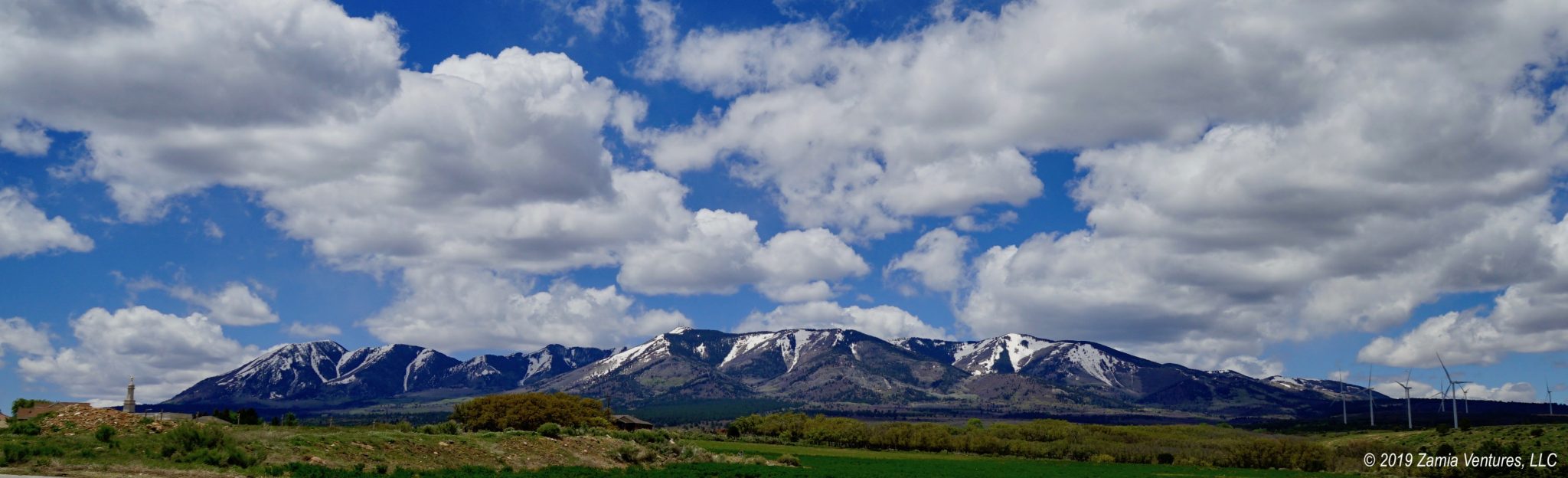
The mountains to the west of Monticello are officially named the Abajo Mountains, but are also called the Blue Mountains. There is even a third nickname: the Horsehead Mountains. That name derives from an interesting visual effect on one of the hillsides. The configuration of trees, meadows, and canyons on the second peak from the right (as seen from town) really looks like the head of a horse with a white blaze on its face and perky ears. Once you see the image on the mountainside, it’s impossible NOT to see the horse head, so the nickname definitely makes sense. It also explains why several businesses in town have “horsehead” in their names.
After a lengthy period of outpatient treatment, Ken finally received his medical clearance to leave the area (with a prescription for oral antibiotics, naturally), so now we’re headed to Cortez, Colorado to explore Mesa Verde and other ancient ruins.
Wow – what a scare! Happy to hear that Ken has recovered.
Yes! We will be taking it easy with the long hikes for a little while, but he is definitely on the road to recovery.
I dunno, man. I often feel like I’m channeling God when I’m typing up campground reviews. All ticked off about the injustice of poor site spacing and failure to trim back the trees… I’m with Marie… sometimes we’re just the vessel through which the Divine complains about stuff.
🙂
And you probably have a larger readership for your blog than she did in all of (microscopic) San Juan County. Come to Monticello sometime and compare your keyboard with her divine typewriter!
We’ve only been to the Needles District in Canyonlands and loved it. I’m glad to hear that it’s still lightly visited because we’re planning a return trip. Don’t tell anyone else how beautiful it is, okay? 🙂 We also loved Natural Bridges and stayed in the campground there. You guys would enjoy it if you return to the area. I agree with you, that ladder on the trail is rickety. They need to replace that thing!
The best news is that Ken is all better and you guys have been turned loose to continue your travels. Happy trails!
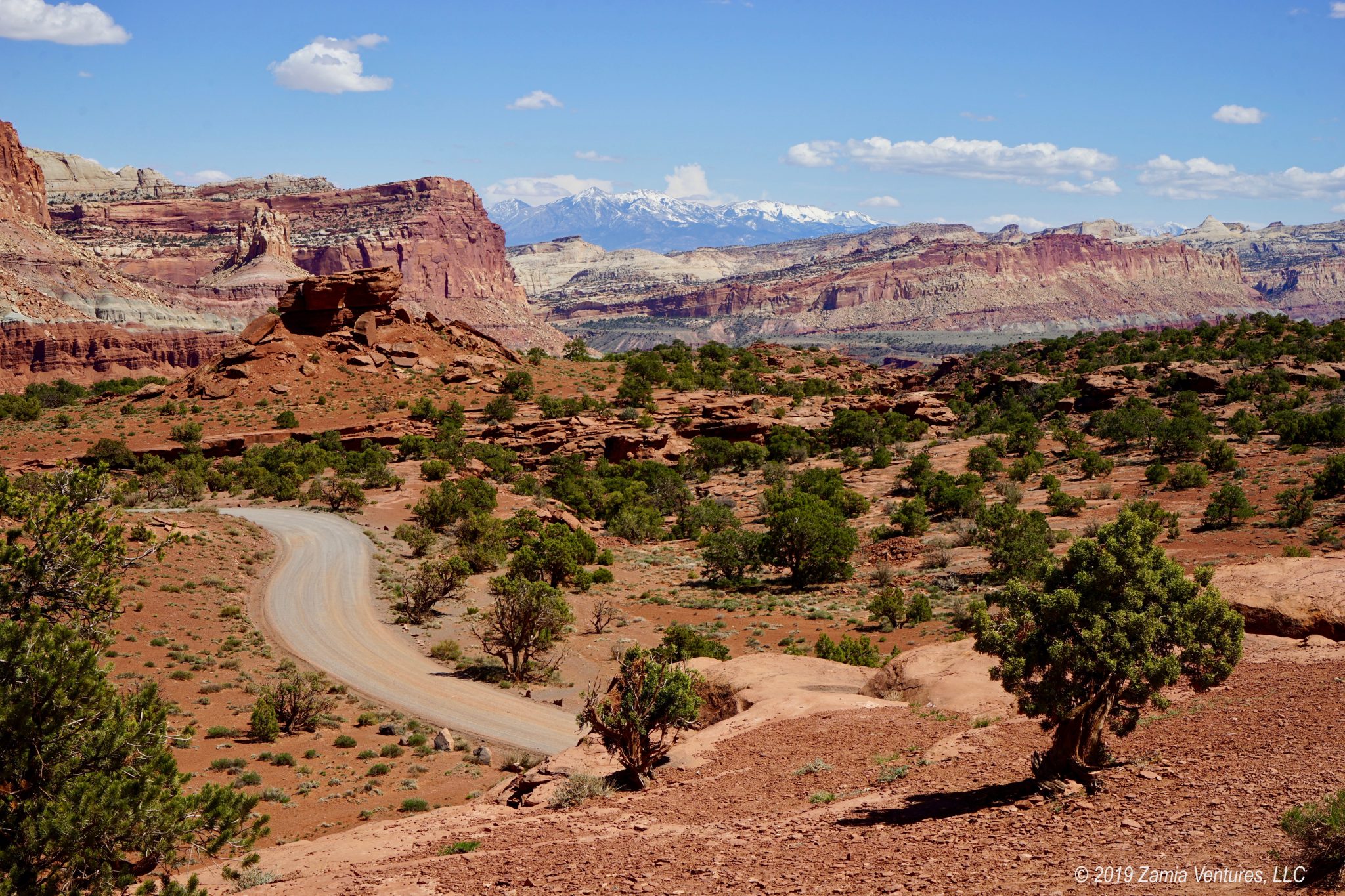
The good news is that Needles and Natural Bridges will probably remain as hidden gems because they are so darn far from everything. I mean, if people can’t be bothered to visit Islands in the Sky, just 35 miles from Moab, there is no way the Needles District is going to become a major destination. I think that’s also the reason for the continuing serenity of Capitol Reef. Luckily RVers are a tough crowd who like getting out into the wild, so we get to enjoy all these interesting places.
If you have to be waylaid somewhere, that looks like a good place to do it. We, too, are caught between our dislike of the crowds and being part of them. It’s good to know that there are still such breathtaking places to see without having to take turns to see them. Glad that Ken is cleared for takeoff, and we’re looking forward to the next adventure post!
Agreed– it wasn’t a bad place to spend an extra several weeks. And the natural attractions in that area are sparsely visited, to say the least, which we find particularly calming. But we are very excited to be on the move again!
Hey I have a podcast and we just checked in with some folks in Monticello. We’d like to flash this iame in a short about the horse’s head. Can we use this image in our video?
https://zamiaventures.com/wp/wp-content/uploads/2019/05/Monticello-Horsehead-Circled.jpg
Tom Wurdock
651 315 5943
Yes, that would be fine!