
When planning our route for 2018, we expected that a summertime visit to the Crown of the Continent – Glacier National Park – would be a highlight. So far, it has completely lived up to our expectations. We approached the park from the east, where we were rewarded after an incredibly long drive across the flat plains of Montana with the almost unbelievable sight of rugged snow-capped mountains jutting up from the plains west of Browning. We spent a week and a half exploring the eastern side of the park, accessing different areas of the park through each of the four entrances on the east side. We hiked just about every day, and every location we visited was absolutely spectacular.
Our pace of hiking was probably slower than usual, but for good reason. Significant elevation gain figured into many of the hikes, and we were also stopping quite often to gape at the scenery and wildlife surrounding us. Open fields featured an explosion of wildflowers, and streams and lakes were filled with water so clear it would be easy to count the stones on the bottom. All our cameras, large and small, totally failed to capture the place. As Ken pointed out repeatedly, with his characteristic exuberance, “This definitely doesn’t suck.”


We visited the eastern portion of Glacier during the first two weeks of July, and were proud to spend Independence Day appreciating some of the greatest landscapes our country offers. Here are recaps of a few of the locations that we loved.
Iceberg Lake
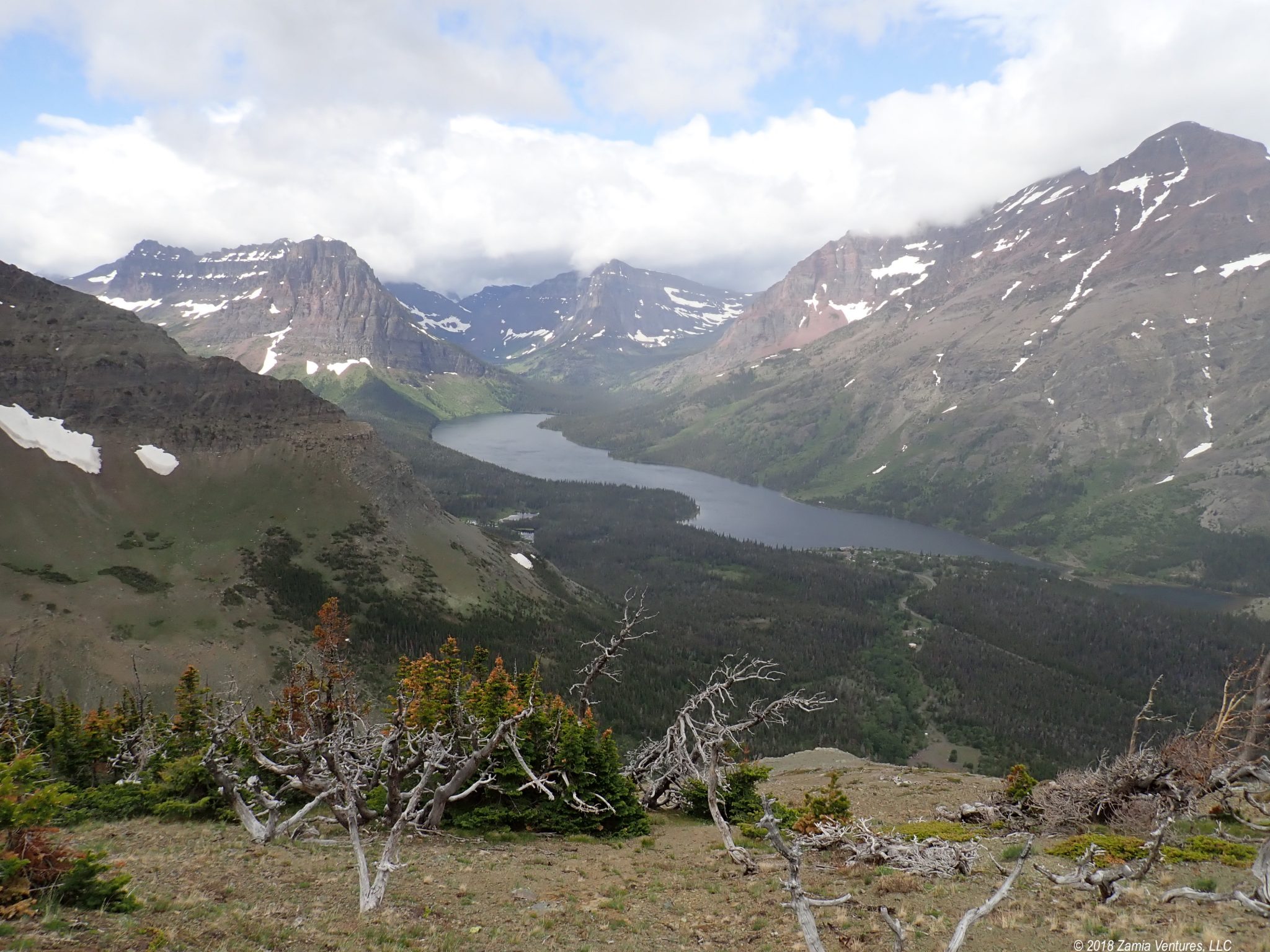
The Iceberg Lake Trail out of the Many Glacier area is one of the most popular trails in the park, and justifiably so. It is probably the most scenic hike we’ve ever done. Over the course of 5 miles (one way), the trail gradually ascends 1,200 feet to the head of a glacier-carved valley. The trail occasionally travels through dense conifer forest, and crosses over a fast-moving stream just above Ptarmigan Falls. But for the most part the trail offers wide-open vistas to the distant mountain peaks towering over the valley.


Around every turn we had a different yet breathtaking view. Near the end, the trail passes by some lovely alpine meadows and a greenish glacier-fed lake flanked by towering cliffs. In addition to the incredible scenery, we also saw a lot of wildlife, ranging from a moose in the valley below to numerous mountain goats and big horn sheep high in the mountains above us. A credible source on the trail told us that three wolves had been spotted hunting high up in the mountains that very morning. Of course, even with binoculars these animals were not much more than dots, since the distances between mountain peaks are so vast it defies comprehension.


At the end of the hike is the feature that gives the trail its name: Iceberg Lake, a glacial lake that is surrounded by an amphitheater of high peaks, keeping the lake shaded and filled with floating ice even in the summer months. Everything about this place was astonishing, from the utter clarity of the water to the surreal experience of seeing so much snow and ice in July.


Of course, this was also the most crowded hike we’ve done. There were literally more people on the trail with us on this one hike than we have seen, in aggregate, during our hikes over the last 5 months on the road. The good news is that only time this detracted from our experience was at Iceberg Lake itself, where the lake’s natural serenity was replaced by the noise of a large crowd of people milling around, taking photos, eating snacks, and chatting. During the rest of the hike, the wide open scenery, the huge scale of the views, and the gaps between groups of people made the crowd situation far more tolerable. Had we seen the same number of people in a canyon or a more enclosed setting, or lined out across an open plain in a never-ending parade, it probably would have been a lot more unpleasant.
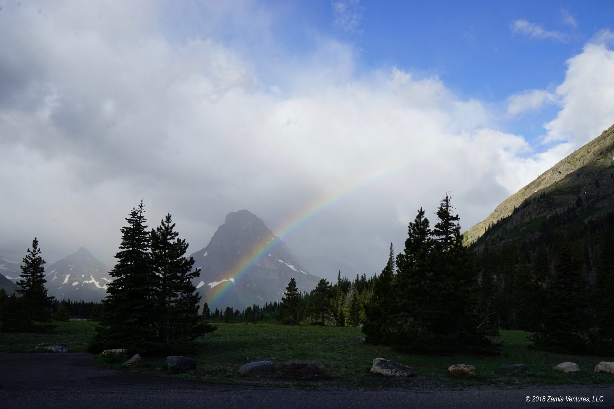
Logan Pass / Highline Trail
Logan Pass is another very popular area, since driving the Going to the Sun Road through the heart of the park is one of the main attractions of the park and Logan Pass sits directly on the Continental Divide along this route. I’m happy to report that the park offers a free and convenient shuttle bus system along the Going to the Sun Road, since we had no particular desire to drive our big truck up this winding mountain road bounded by sheer cliffs.

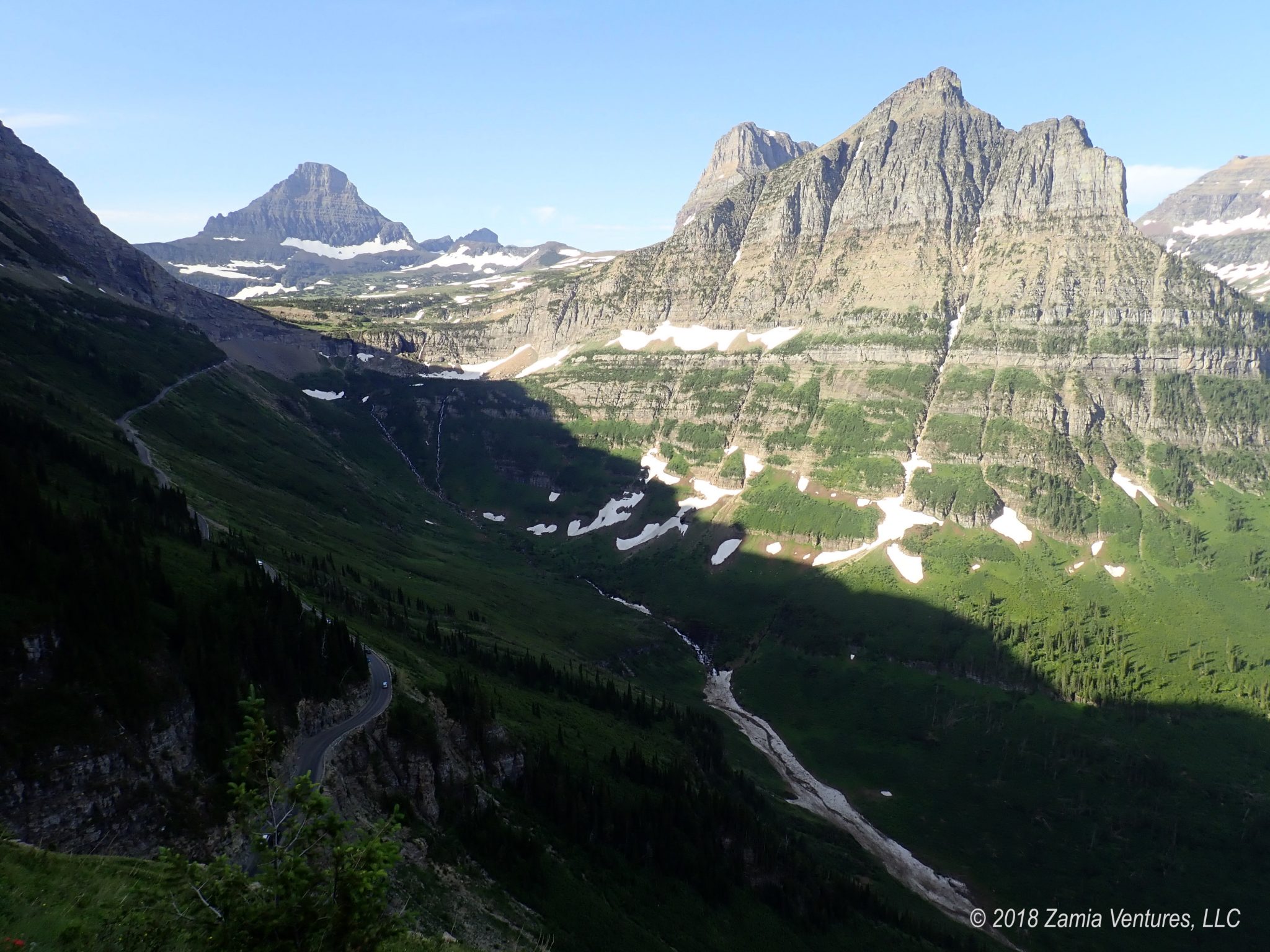
Once we arrived at Logan via the shuttle, we set off on the Highline Trail, which is another of the most popular trails in the park. The trail hugs the western side of the Continental Divide, moving along for miles with relatively little elevation change until it becomes a bit more technical. We chose to do a relatively short out-and-back along the trail (2.5 miles each way) in part because I was hauling my full camera set up with my big zoom lens in hopes of spotting mountain goats and bighorn sheep in this high elevation.


While not particularly taxing in terms of elevation gain, at least not on the section we covered, this trail is not for the faint of heart. Within the first mile it turns from a normal trail into something that gives acrophobes nightmares: a thin ribbon of cleared rock hugging the side of a cliff, with a 100+ foot drop straight down the side of the trail. The park service does provide a steel cable to hang onto during this section, but it’s still a bit unnerving. We witnessed other hikers literally shrieking in dismay at the sight of this area, and nearly crawling along the cable to reach the end of this section. (I swear, that wasn’t us!)

Even after the toughest cliff area, the trail continues to be a narrow path flanked by a steep drop-off, but the payoff is endless views toward the western portion of the park and back toward Logan Pass. Also, it was totally unnecessary to bring my zoom lens, since the animals I was seeking were parked literally feet from the trail or, in the case of one energetic mountain goat, on the trail. It was just awesome to see a large group of bighorn sheep calmly grazing next to the trail in the early morning, and a surprise to see a mountain goat ambling down the trail in our direction a short time later. I know how mean goats can be, so we got out of the way! We also spotted a research goat that sported a radio collar, lulling researchers into complacency by laying calmly alongside the trail. Clearly, the views and wildlife did not disappoint on this trail despite the relatively high traffic on the trail.


Cut Bank / Medicine Grizzly
The Cut Bank entrance to Glacier is somewhat of a hidden gem, since it lies 5 miles down a gravel road between the Two Medicine and St. Mary areas. We tackled our longest hike of the east side here, and were pleased to encounter fewer than 10 other hikers during the time we spent on the 13-mile hike. The Cut Bank area is home to an interesting geographical feature: Triple Divide Peak. This mountain is part of both the Continental Divide and the Hudson Bay Divide. Rain or snow that falls on its west side drains into the Columbia and eventually the Pacific. Precipitation on the northeast side drains into the Saskatchewan River and emerges in Hudson Bay. Rain on the southeast side is just beginning a cross-continental journey to the Missouri River, the Mississippi, and ultimately the Gulf of Mexico. It’s a real testament to the power of chance that rain drops falling just a few feet apart around the peak of this mountain will end up in such vastly different places.


While we toyed with the idea of tackling the Triple Divide Pass Trail, we decided the 15 mile total length combined with almost 2,500 feet in elevation gain was a little bit beyond our comfort zone. Instead, we hiked out to Medicine Grizzly Lake, the alpine lake that lies just below the Triple Divide Peak. This way, we enjoyed great views of the peak itself along with the lovely lake, and the hike took us miles along the crystal-clear north fork of the Cut Bank River through fields of wildflowers and coniferous forests.


Two Medicine – Lake Loop
A long but relatively flat hike that circles Two Medicine Lake was an easy choice for a day’s adventure in the Two Medicine area. While the trail has heavy traffic around the waterfalls that are close to the historic camp store and boat landing areas at each end of the lake, the longer distances along the sides of the lake are only moderately busy, and we loved getting different perspectives on the mountains we had been gazing at for days from our campsite.


No Name Lake
As a 10-mile hike (round trip) that we tackled directly from our campsite at Two Medicine, the No Name Lake Trail seemed to be right in our wheelhouse. It turned out that this was surprisingly tough, because it packs virtually all of its 800 feet of elevation gain into a small stretch of absolutely brutal switchbacks. After all that hard work, the payoff is a stop at a secluded glacial lake, where the water is so clear it defies belief. A group of three intrepid young women who passed us on the trail on the way up chose to cool off by jumping in the lake. While I was totally drenched in sweat, there was no way I was putting more than a few fingertips into that frigid water! But we did love the serenity of the lake and the relatively small number of people we saw on the trail.


Scenic Point
The Scenic Point Trail at Two Medicine is only 4 miles long (8 miles round trip) when walking from the campground but it’s straight up the side of a mountain, with 2,350 feet of elevation gain. Fortunately it’s easy to explain taking frequent breaks, since the panoramic views are breathtaking and demand lots of photos, especially since the trail gets above the treeline very quickly. The trail is narrow and at times seemed more like a goat path than an actual trail, yet Ken handled the scary heights like a trooper.


Several decades of watching hurricane coverage on The Weather Channel prepared us well for this hike. Small weather squalls blew through the area during our hike, which meant that when the clouds passed by we were buffeted by 30-40 mph winds. Assuming the Jim Cantore position (back to the wind in an angled semi-crouch) meant that we didn’t have to worry about getting blown off the mountain.
Meanwhile Back at the Ranch
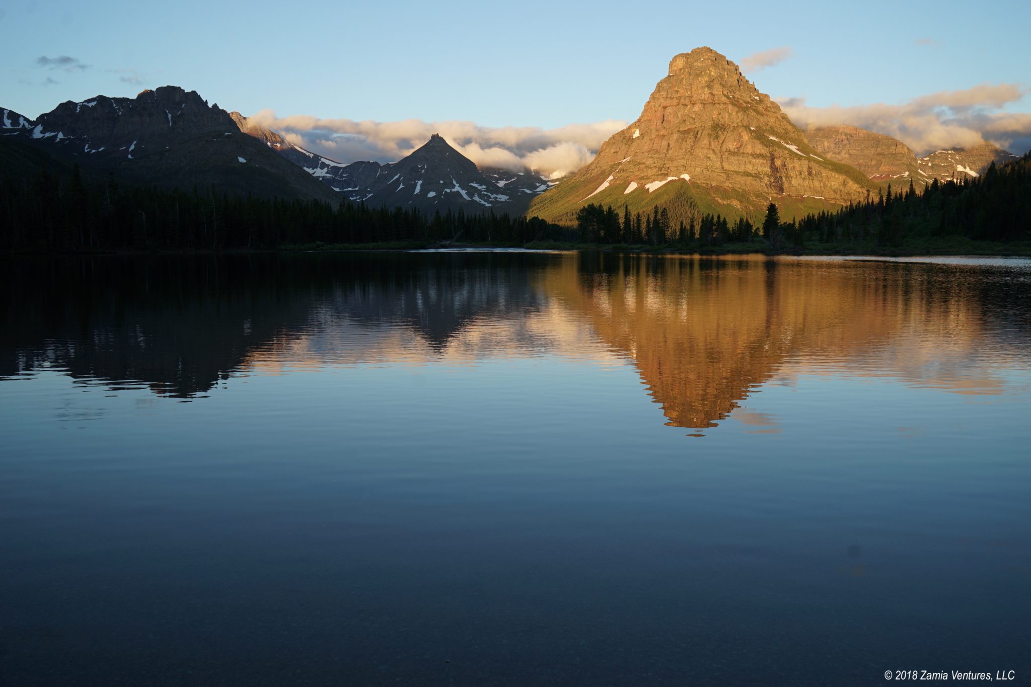
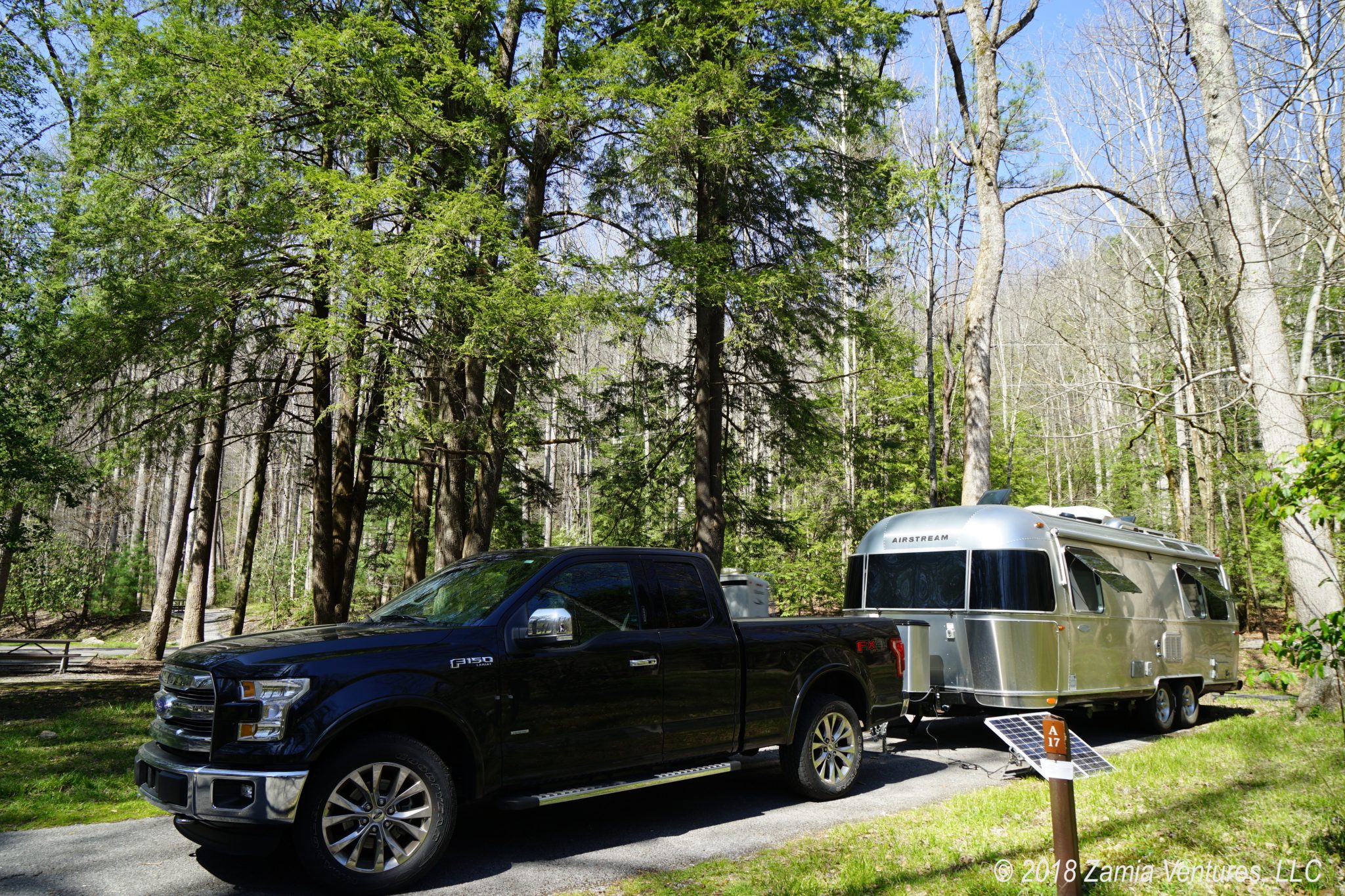
Our base of operation for the bulk of our stay on the east side was the campground at Two Medicine. We arrived early on a Sunday morning in hopes of securing a decent campsite in this first-come-first-serve location. Somehow we scored an unbelievable site, fronting on a small lake fed by the main Two Medicine Lake, with direct views of Sinopah Mountain to greet us every morning. Our site was open enough to allow for excellent solar power generation, so we never needed to run the generator during our stay.


We had originally planned to split our time between Two Medicine and Many Glacier, but our day trip to Many Glacier for the Iceberg Lake hike revealed that the road into the park from Babb, Montana to the recreation area is absolutely horrible, with gigantic potholes and sections of missing pavement. We quickly determined that we were not comfortable towing our house over that road. We also had such a great site at Two Medicine that we knew we would be downgrading by moving. Finally, the town of East Glacier Park, outside the Two Medicine entrance, has a gas station, a small grocery store, and AT&T cell service – three things that are all lacking outside the Many Glacier entrance. It was an easy decision to stay put at Two Medicine for most of our time on the east side of the park.
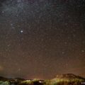
We also spent two nights at the campground in St. Mary, specifically to have ready access to the shuttle up Going to the Sun Road. While the campground at St. Mary is not nearly as scenic as Two Medicine, it does have showers, which were extremely welcome after several weeks of navy showers in the trailer. St. Mary also had surprisingly dark skies during the new moon, and we loved having 360 degree views of millions of stars overhead, with the Milky Way splashed across the sky.
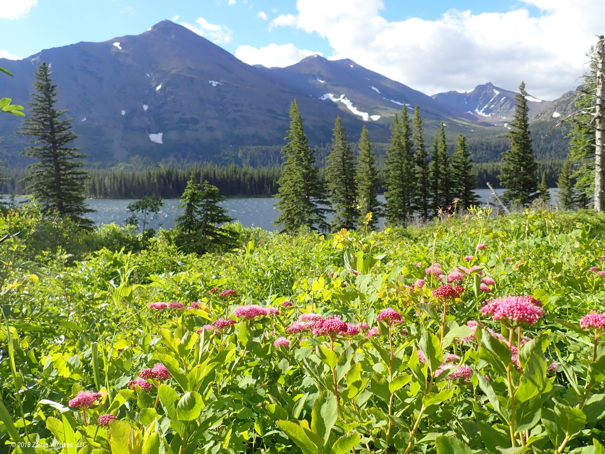
Wildlife and Wildflowers Galore
The mountains of Glacier are impossibly huge and imposing, and create stunning panoramas in every direction. Yet while the geology is grand, my overwhelming impression of this place is of its liveliness. Everywhere we went on the east side of the park we encountered flourishing landscapes filled with riots of wildflowers, profusions of bees and butterflies, constant birdsong, and huge animals like bears, sheep, moose, and goats. Glacier is reportedly one of the few places left in North America where all the native carnivores – black and grizzly bears, wolves, and mountain lions – survive and thrive.


The only negative, I suppose, is the National Park Service predictions that the remainder of the already-shrunken glaciers in the park will melt by 2030 as a result of climate change. This will inevitably change the ecosystem for the park’s inhabitants and visitors. We count ourselves lucky to have seen Glacier in the last of its glory days, because it has been truly glorious.
Next Moves
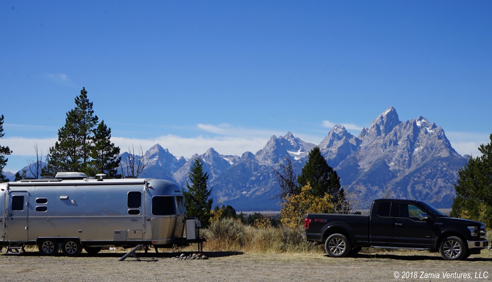
For now, we’re taking a breather for a few days and staying at a full-service private RV park near Kalispell, where we have easy access to all sorts of necessary services. After all that kayaking and hiking, our laundry hamper is close to being declared a Superfund site. And we can finally restock on many essentials, since we have the chance to visit our first Costco since Omaha. During the times that I was struggling the most to climb up steep trails, the thought of takeout pizza helped keep me going. Now, those dreams of clean clothes and pizza will be realized while we plan our approach to the west side of Glacier National Park.
These photos are outstanding! What a gorgeous place and it sounds like you found some fantastic hikes to highlight the best of it. I’m not sure when we’ll make it up to Glacier, but whenever we do, we’ll want to follow in your footsteps because these seem like our kind of trails. Of course, I’ll also have to research the patented “Weather Channel stance” to ensure we don’t end up getting blown right off a mountain. Who knew? 😂 Glad to see luck has been on your side with the campgrounds and the weather. Enjoy the full hook ups, laundry, and pizza. It is amazing how much happiness those things can bring!
We loved Glacier and were constantly wowed by the scenery and the wildlife. The hardest part was not taking good photos, it was deciding which of the thousands of photos would make it into the blog! A big challenge with this park is finding trails that are somewhat less traveled, since it is popular and all those visitors are compressed into a short season. Hitting the more primitive entrances like Cut Bank is the way to go, in my opinion. Also, no lie, I was close to tearing up when we walked into Costco yesterday. We’ve been living on frozen and canned vegetables for so long that I went a bit crazy in the veggie section. 🙂
Terrific report and amazing photos of the gorgeous landscape you have travailed. Those hikes sound very exhausting but also exhilarating. I am so glad that you are taking full advantage of this wonderful opportunity to see so many diverse places in our country.
One benefit of all the hiking is that we don’t have to feel guilty about eating chips! Besides the snacking opportunities, one of my favorite things about the journey has been the lack of a schedule. It was great to make the impromptu decision to stick around Two Medicine for a long stay, since we loved the area so much.
One word again………….outstanding!!!!!!!!!!!
That’s what we kept saying to ourselves!